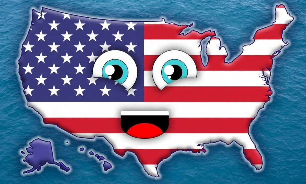
The United States has many lesser-known records and unique distinctions. It is a land of diverse landscapes, rich history, and fascinating peculiarities that often go unnoticed. From scorching deserts to icy tundras and densely populated metropolises to vast, uninhabited wilderness, the country offers a plethora of surprises for those willing to explore its lesser-known facts.
Death Valley's Anomalous Heat Record
Death Valley, California, is the hottest air temperature ever recorded on Earth. On July 10, 1913, the temperature soared to a staggering 134°F (56.7°C). This record, still standing over a century later, is a testament to the extreme climate of this region. Located in the Mojave Desert, Death Valley is a land of extremes, not only in temperature but also in geography. It is one of the driest places in North America, with an average annual rainfall of less than two inches. Visitors to this otherworldly landscape can experience the immense heat firsthand, particularly during the summer when the temperature regularly surpasses 120°F (49°C).

The geological forces that shaped Death Valley contribute to its scorching climate. The area sits below sea level while mountains surround it, which trap the hot air and prevent it from escaping. These conditions make Death Valley a natural heat trap, contributing to its record-breaking temperatures. Despite its harsh environment, Death Valley is home to various plant and animal species, some of which have adapted to survive in this unforgiving climate.
Hawaii's Incurvate Boundaries
Hawaii stands apart from most U.S. states with straight or neatly defined borders. It is the only U.S. state without a single straight border. Hawaii's boundaries are entirely natural, formed by the curves and contours of its islands. The distinction sets Hawaii apart from the mainland states, where borders were often drawn based on political agreements or geographical markers like rivers and mountain ranges. In contrast, Hawaii's boundaries result from volcanic activity and erosion over millions of years.

Hawaii's curved borders reflect its isolated location in the Pacific Ocean, more than 2,000 miles from the nearest continental landmass. The isolation has shaped the state's unique culture, flora, and fauna. Hawaii is home to numerous endemic species found nowhere else on Earth, thanks to its isolation from the rest of the world. The state's distinct borders serve as a reminder of its geological history and the forces that continue to shape its islands today.
The Southernmost Point: American Samoa
When thinking of the southernmost point of the United States, most people would likely guess Key West, Florida, or perhaps somewhere in Hawaii. However, the accurate southernmost point of the U.S. is in American Samoa, a U.S. territory in the South Pacific. Specifically, the southernmost point is at Rose Atoll, part of the American Samoa territory. Since American Samoa is not part of the contiguous United States, its remote location makes it less familiar to most Americans.
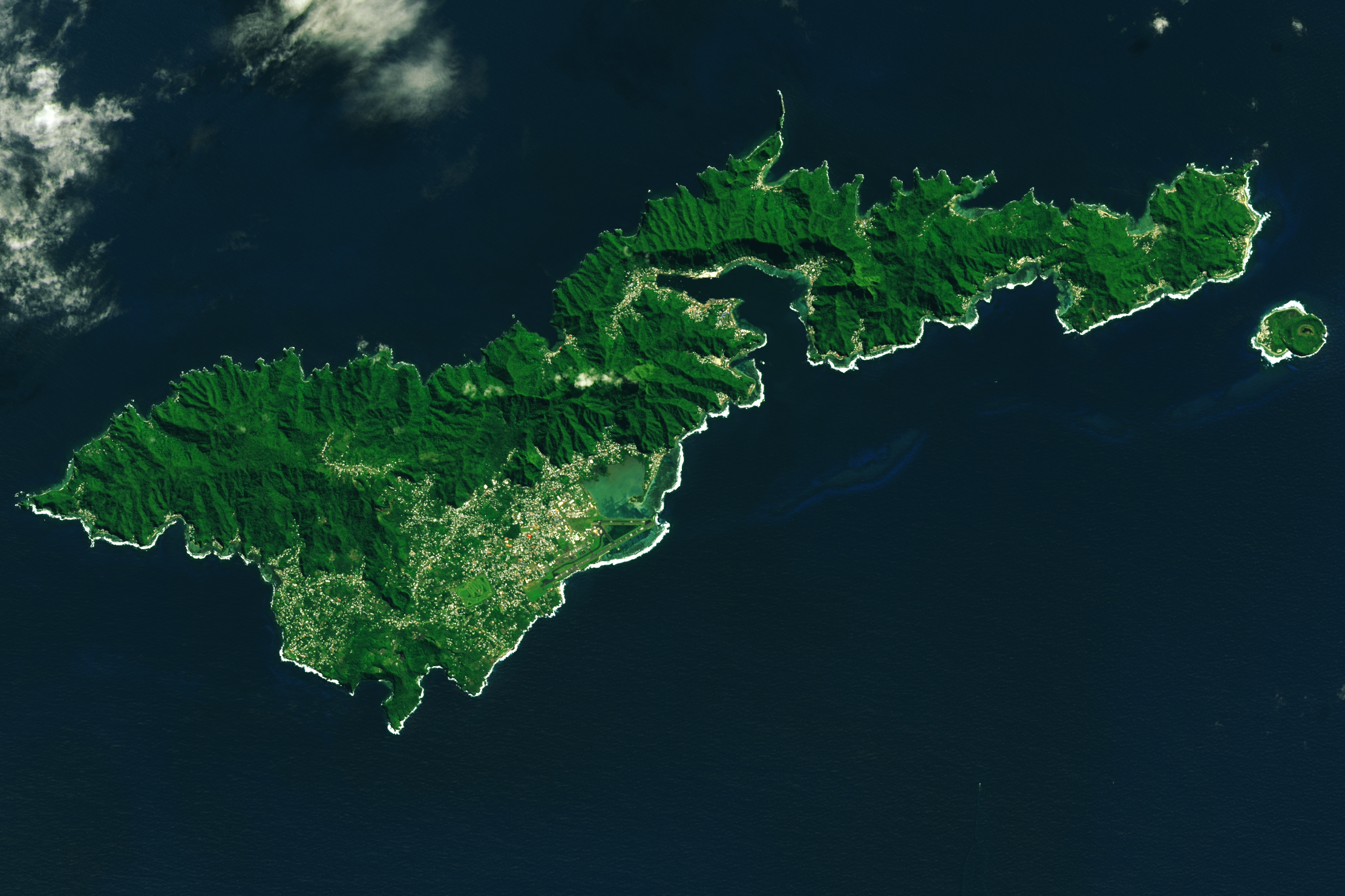
American Samoa's geographical distinction as the southernmost point of the U.S. highlights the vast reach of the nation's territories, extending far beyond the mainland. This remote island territory, located over 2,500 miles south of Hawaii, is home to a unique culture and many species of marine life. The atolls and islands of American Samoa are surrounded by some of the most pristine coral reefs in the world, making it a key area for marine conservation efforts.
Alaska's Unparalleled Size & Geographic Status
Alaska is often associated with vast wilderness and cold climates, but it also holds some surprising geographic records. The state comprises about 20% of the total U.S. land area, making it the largest geographical area of all states. However, despite its enormous size, Alaska is home to less than 1% of the U.S. population. Contrasts between size and population density make Alaska unique, with vast untouched wilderness that remains largely uninhabited.
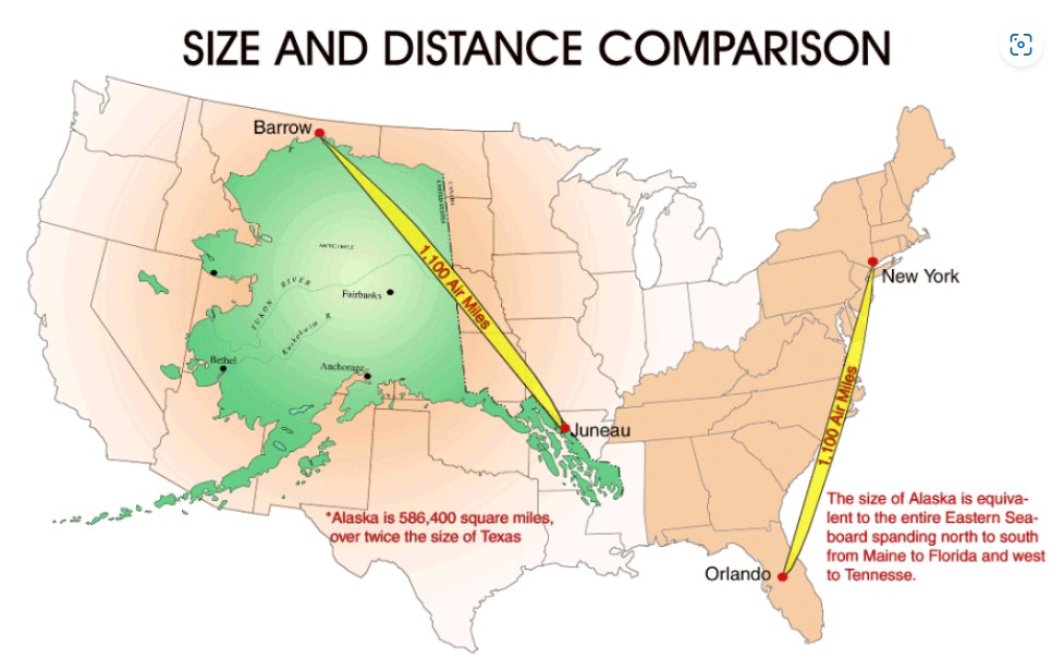
In addition to its sheer size, Alaska is also geographically unique. It is the most western, northern, and eastern state in the U.S. due to the 180th Meridian crossing through the Aleutian Islands, which technically places part of Alaska in the Eastern Hemisphere. This unusual geographic positioning makes Alaska the only state to span both hemispheres, adding to its list of geographical superlatives.
The state's diverse landscapes range from towering mountains and glaciers to expansive tundras and dense forests. Alaska's geographic features and low population density make it a haven for wildlife and outdoor enthusiasts. The state's national parks and protected areas are some of the largest in the country, offering visitors the chance to experience nature on an epic scale.
Minnesota's Geographic Eccentricity: The Northwest Angle
Minnesota is known for its 10,000 lakes, but one lesser-known geographic oddity is the Northwest Angle. This small portion of the state is entirely separated from the rest of Minnesota by Lake of the Woods and surrounded by Canadian territory. To reach the Northwest Angle by land, one must cross into Canada and then re-enter the U.S. This geographic anomaly dates back to an 18th-century mapping error during negotiations between the United States and Great Britain over the border between the two countries.
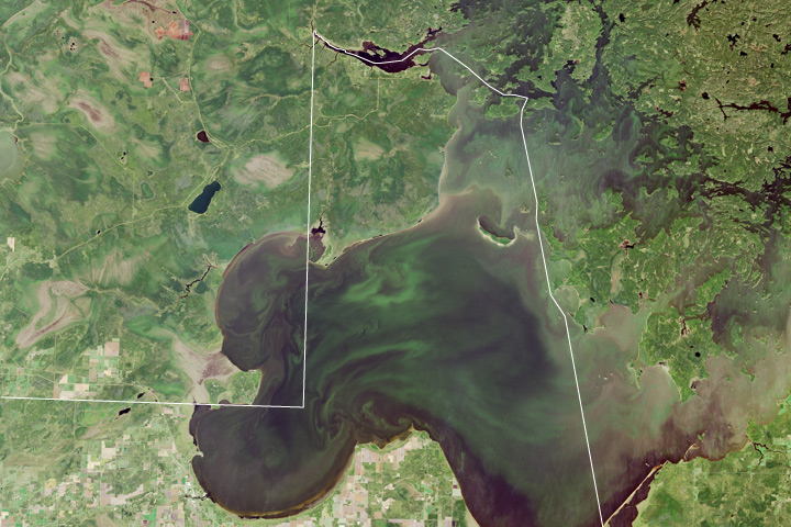
The Northwest Angle is the northernmost point of the contiguous United States and is home to a small population. Its isolation from the rest of the state has led to a unique way of life for its residents, who rely on U.S. and Canadian services. The area is also known for its excellent fishing and outdoor recreation opportunities, drawing visitors from both sides of the border.
Nebraska: The Triple Landlocked State
While often overlooked in unique geographic features, Nebraska holds the distinction of being the only triple landlocked state in the U.S. This means that to reach an ocean from Nebraska, one must travel through at least three other states. Nebraska's central location within the United States places it far from any coast, making it one of the most landlocked states in the country.

Despite its landlocked status, Nebraska's geography is diverse, ranging from the rolling sandhills in the west to the fertile plains of the east. The state's rivers, including the Platte and Missouri, have played a crucial role in its development, providing water for agriculture and transportation routes for settlers. Nebraska's status as a triple landlocked state underscores its central role in the nation's agricultural economy, serving as a breadbasket for the country.
Mount Mon's Stunning Height Advantage
Mount Everest is widely regarded as the tallest mountain in the world when measured from sea level. However, if measured from its base to its peak, Mount Mon, located in Hawaii, surpasses Everest in height. While Everest's peak reaches 29,032 feet above sea level, Mount Mon stands at 13,800 feet above sea level, but when measured from its base on the ocean floor to its summit, it rises over 33,500 feet, making it the tallest mountain on Earth when measured in total height.
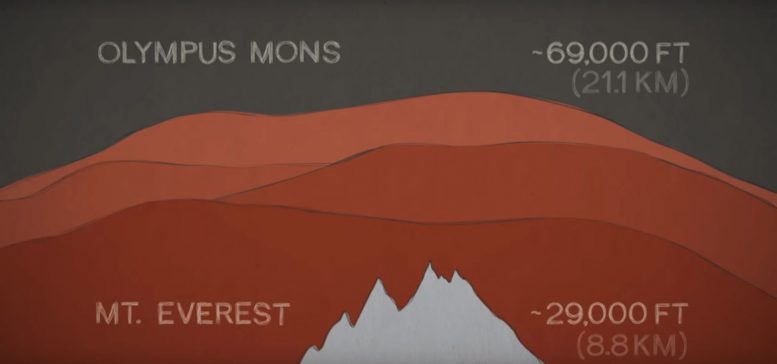
People disregard Mount Mon's towering height because of the near total submersion of the mountain beneath the Pacific Ocean. The volcano is part of the Hawaiian-Emperor Seamount chain. They are a series of volcanic islands and underwater mountains formed by the movement of the Pacific tectonic plate over a hotspot in the Earth's mantle. The immense height of Mount Mon is a reminder of the dynamic geological forces that continue to shape the Hawaiian Islands.
Network of Water Systems
The country's vast network of rivers, lakes, and coastal areas further adds to its geographical complexity. The Great Lakes, shared with Canada, form the largest group of freshwater lakes on Earth by total area. The Mississippi River system has an extensive network of tributaries that drains about 41% of the contiguous United States, playing a crucial role in the country's hydrology, ecology, and economy.
The Built Environment
Beyond its natural features, the United States' built environment also contributes to its geographical uniqueness. The country's extensive highway system, including the Interstate Highway System, spans over 160,000 miles, connecting diverse regions and facilitating the movement of people and goods across vast distances. Urban areas like New York City, with its iconic skyline, and Las Vegas, with its dazzling array of casinos in the middle of the desert, showcase the human ability to transform landscapes and create distinctive geographical features.


You must be logged in to post a comment.